SAN ANGELO, Texas — August will end hot and humid across West Texas. Dew points are set to hover around 70 degrees throughout the day Monday, making it feel more like southeast Texas.
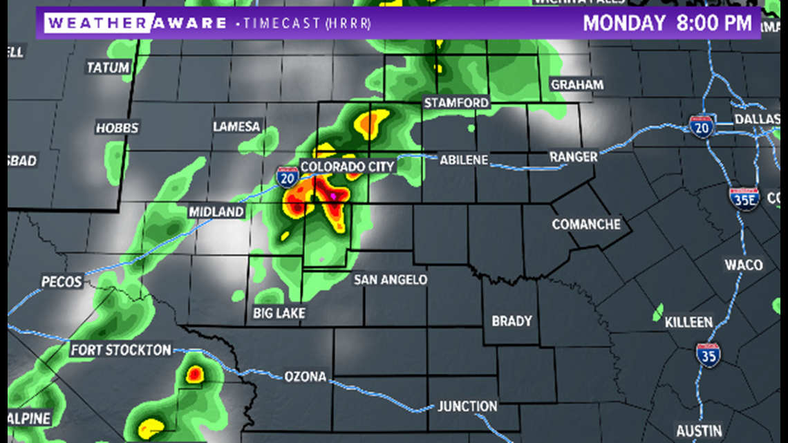
Although humid, much of the day is set to remain dry with a mix of sun and clouds. Temperatures will climb to the upper 90s and low 100s. Monday evening, isolated showers are expected to develop in parts of the Big Country, along I-20.

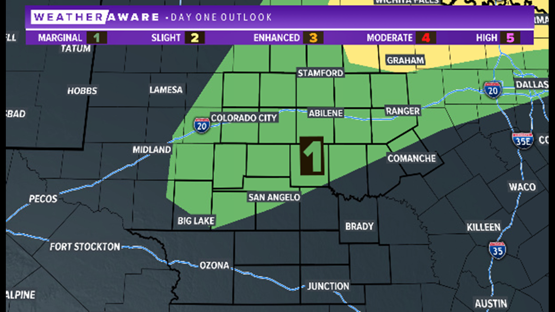
A marginal risk of severe weather (a level one of five) has been highlighted for areas north of San Angelo, including Abilene. Although not expected, an isolated severe storm cannot be ruled out.

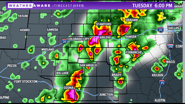
As September starts, additional rain chances move into West Texas. Humidity will stay high, with plenty of moisture available for storm development. Tuesday afternoon, numerous showers and storms will develop. Moderate to heavy rainfall is likely within this activity.

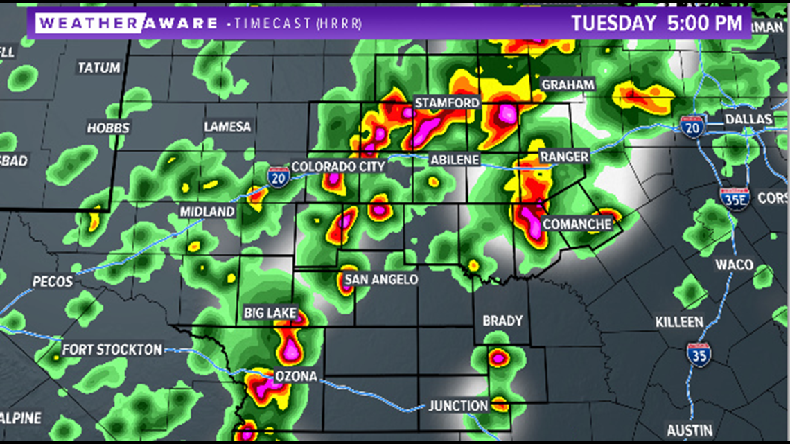
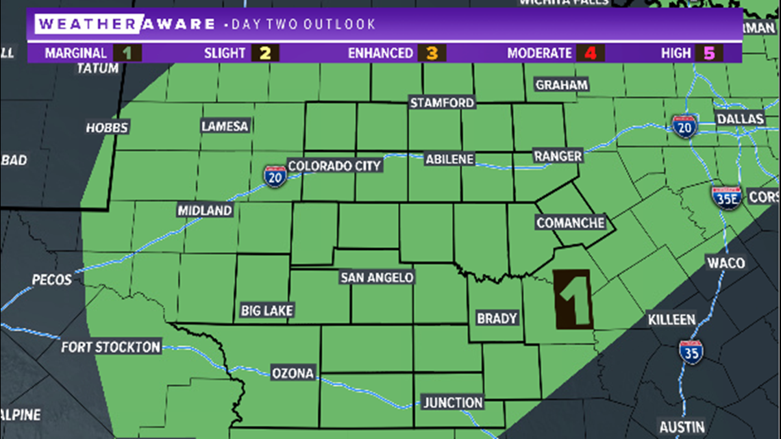
A marginal risk of severe weather (level one of five) is highlighted for the entire area Tuesday.

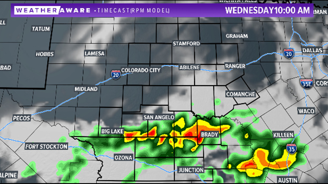
Additional showers and storms are also likely Wednesday. These showers and storms will favor our southeastern areas, which will remain dry the first half of the week.

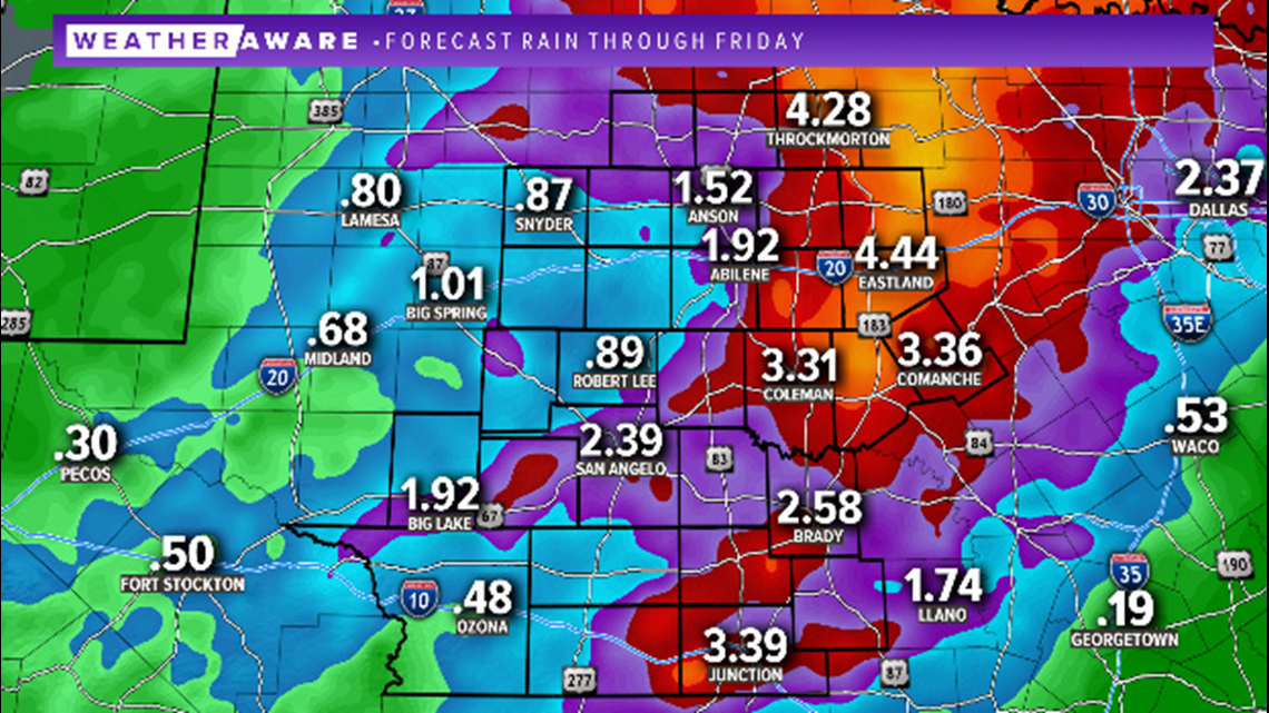
Overall, it will be a wet start to the month of September across the area. Total rainfall totals through Friday may exceed four inches in isolated locations, particularly northeast.

Stay with FOX West Texas for the latest information.


