DALLAS — Hurricane Beryl hit landfall on the Texas coast early Monday morning near Matagorda. We're tracking the latest updates as the storm moves through Texas.
Here's the latest forecast and radar:
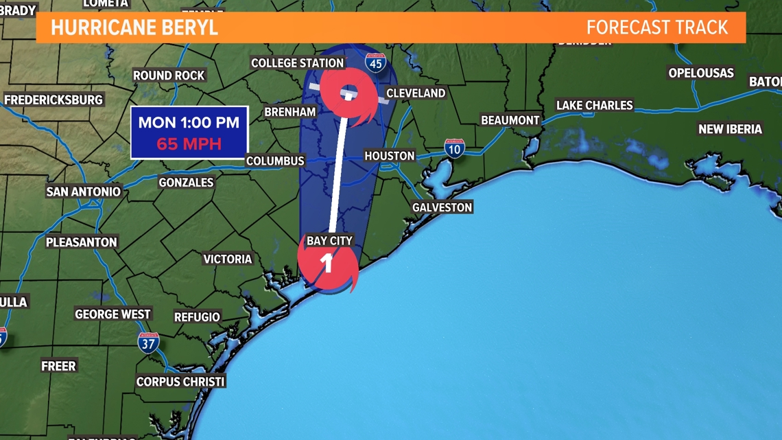
Hurricane Beryl track: Timeline, forecast
Current status
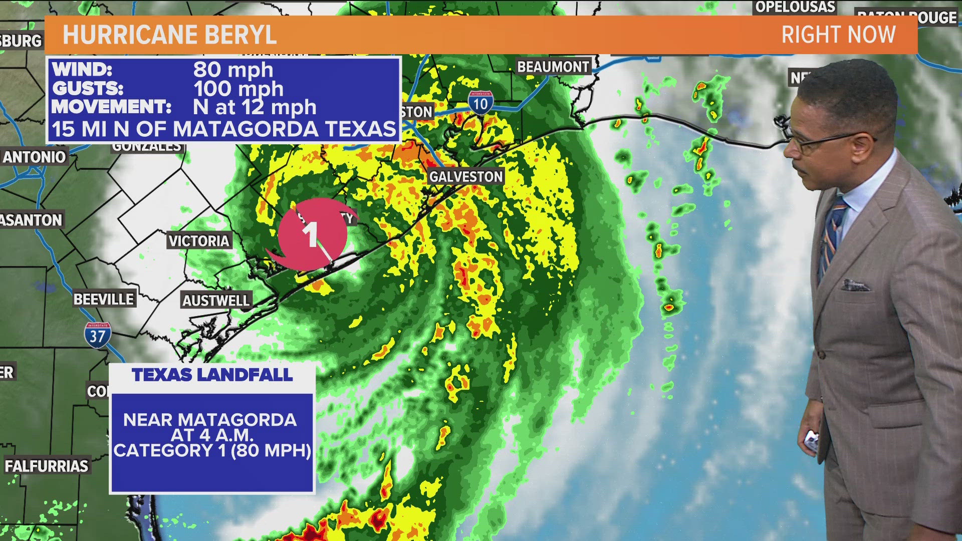
Beryl is still a hurricane. Official landfall was just before 4 a.m. near Matagorda.
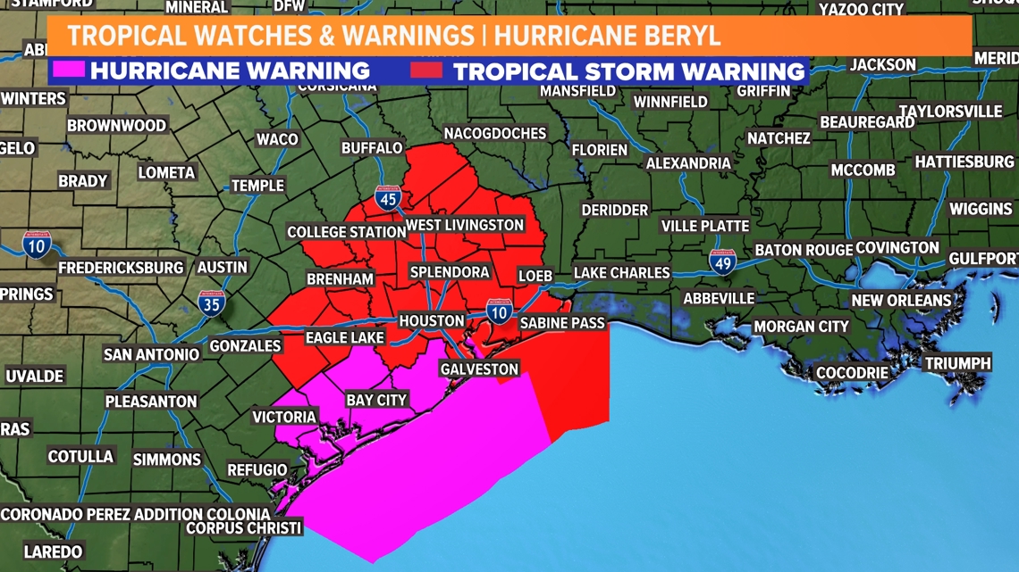
Hurricane warnings and tropical storm warnings remain in effect for much of the Texas coast.


Hurricane Beryl impact on Texas
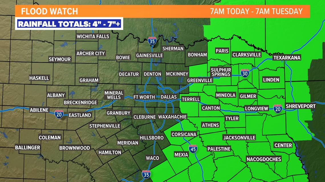
Highest rainfall totals will be in South Texas with accumulations 7-10" (or higher). The remnants of Beryl will move into Central and Northern Texas late Monday. This brings big rain totals to parts of the area. The cutoff on who sees high rain totals and who sees hardly anything will be sharp. Areas EAST of the metroplex will get the most rain. Flood watches are in place for that reason.