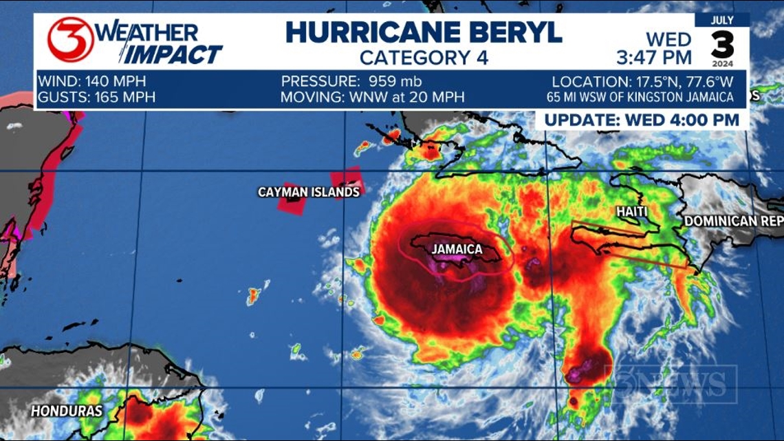
CORPUS CHRISTI, Texas — Hurricane Beryl is a category 4 hurricane with 140 mph sustained winds, passing just south of Jamaica this afternoon. It's moving WNW at 20 mph.

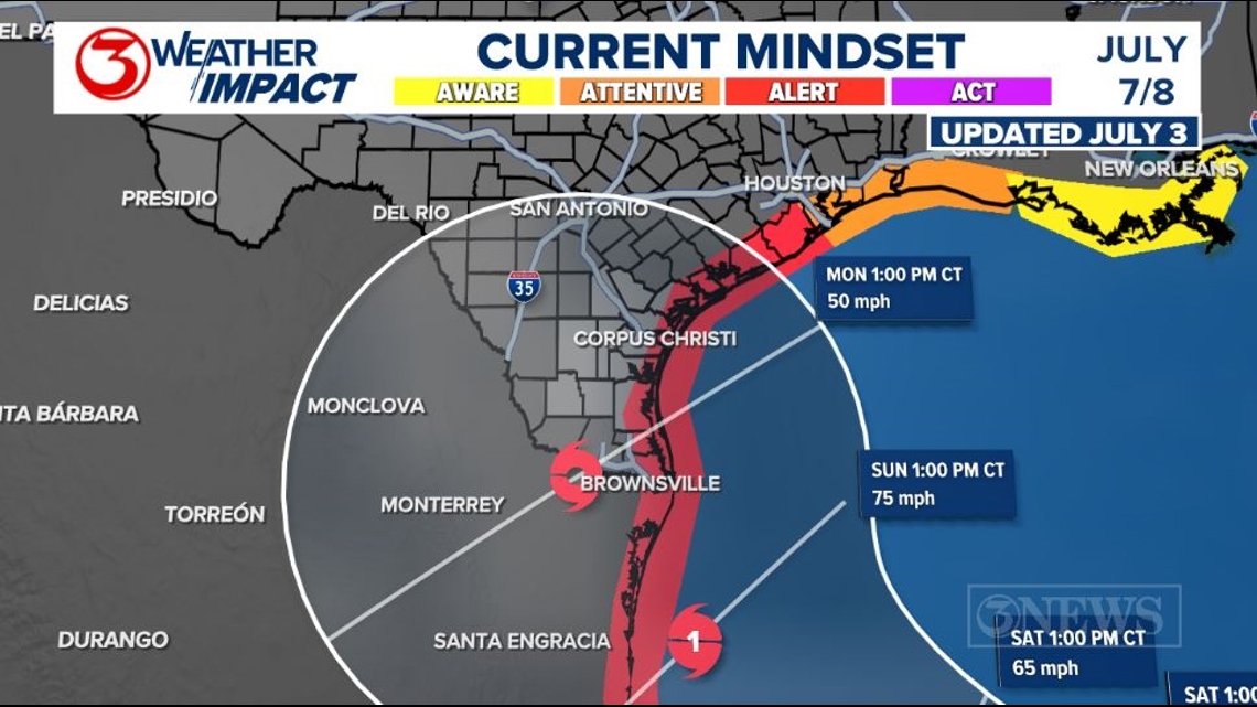
The JULY 3, 4PM forecast cone from the National Hurricane Center shows a weakened tropical storm Beryl emerging in the SW Gulf of Mexico Friday afternoon/evening. Beryl is forecast to move NW through the SW Gulf Saturday and Sunday, regaining hurricane status on Sunday as it approaches the North Mexico coastline. This update shifted the landfall/cone a little southward. If Beryl moves in to N Mexico, it would likely be on Sunday afternoon/evening. However, if Beryl stays on the right side of the cone, it wouldn't be until Monday, moving in to South Texas.

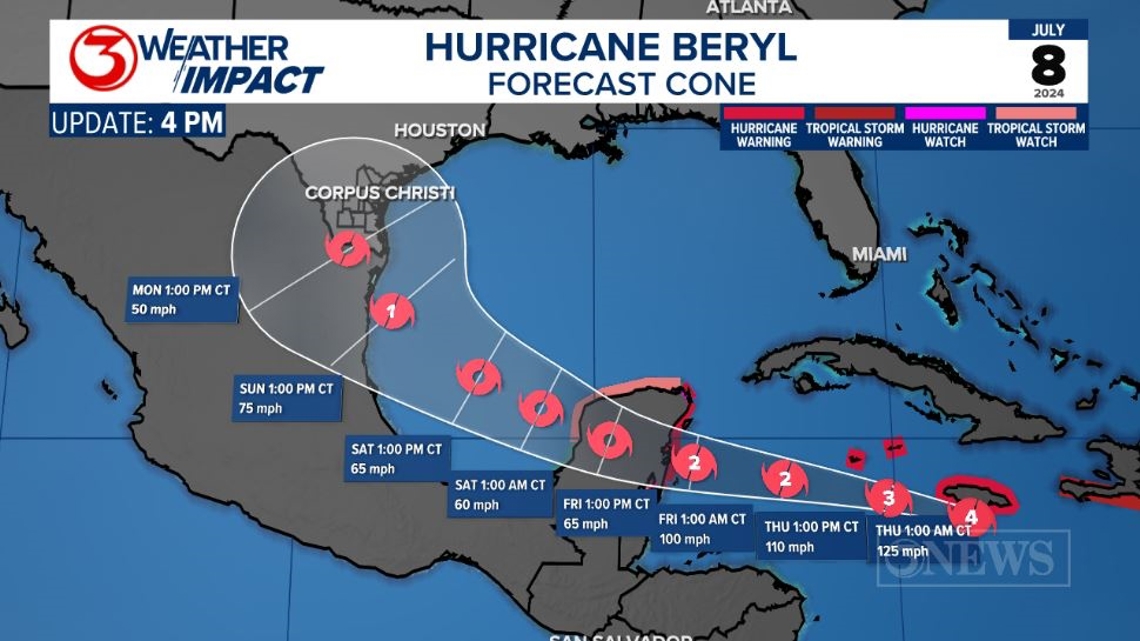
The wind forecast on this forecast cone brings a low-end chance for tropical storm force conditions to the Coastal Bend Sunday/Monday. Tropical storm force begins at 39 mph sustained winds.

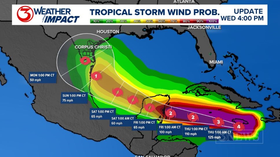
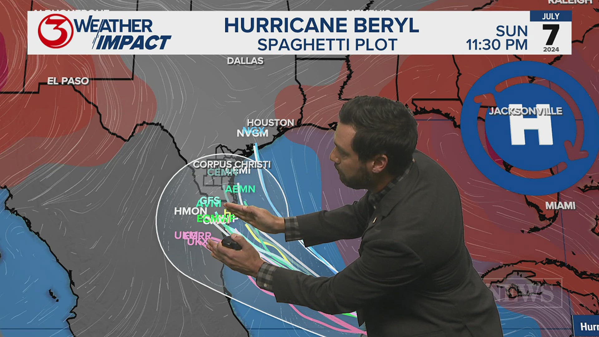
Forecast models are beginning to key in on a Northeast Mexico or Southern Texas landfall into Sunday night or Monday. The more south the storm is, the earlier it'll move in. The more north the storm is, the later it will move in.

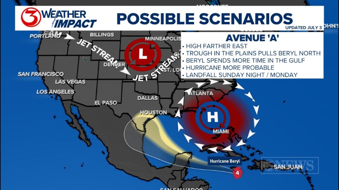
I think there are two plausible scenarios on the table at this point. In avenue 'A', Beryl tracks on the northern envelope of the forecast cone as a trough to the north tugs on Beryl, pulling it northward. This northward movement would give Beryl more time over the Gulf and push landfall back to Monday morning. It means more time for strengthening and more hazards in play for the Coastal Bend. This scenario could deliver a hurricane to Texas.

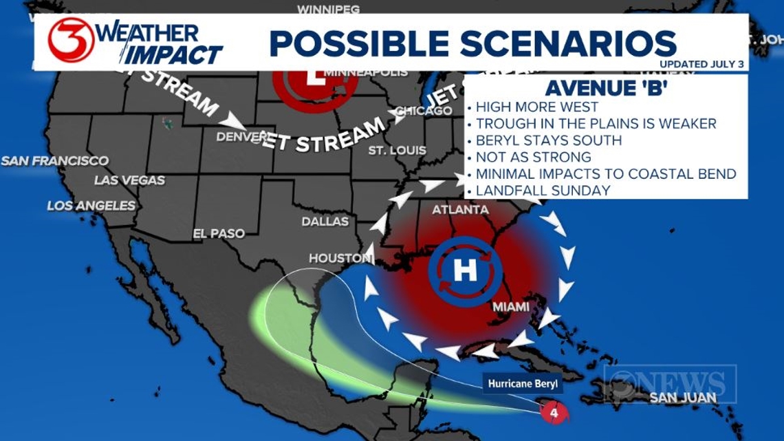
In avenue 'B', Beryl stays farther south, away from the influence of the trough, moving in to Mexico likely as a strong tropical storm or category 1 hurricane on Sunday. This scenario would keep much of the hazards from Beryl well south of the Coastal Bend, but we'd still observe elevated surf, coastal flooding, and a high rip current risk. In this more southward scenario, I also think rain is minimal here and winds stay well below tropical storm force.

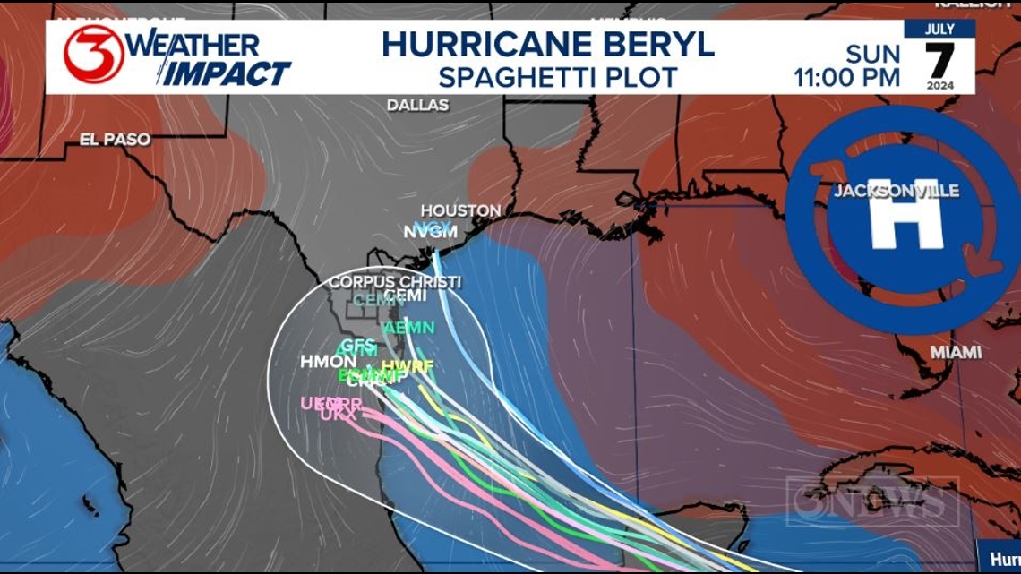
As of 4pm, July 3, I am leaning more toward the avenue 'B' scenario. This afternoon's spaghetti plot is starting to hone in on Northeastern Mexico, but there are still some outliers bringing the storm more to the north. Confidence is small, but today is really the first time that I've started to see a somewhat more reliable trend.
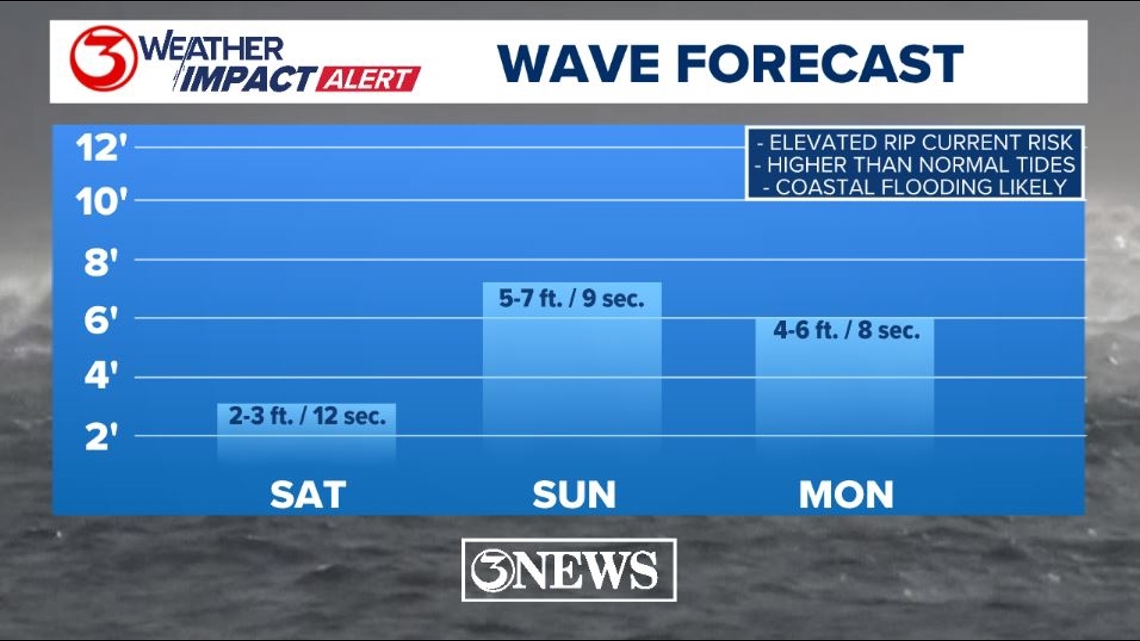
Regardless of track, wave activity will pick up, starting with long period swells moving in on Saturday, then wave heights increasing on Sunday/Monday. A new moon on Friday will also have an additional gravitational pull on tides in the area, which will increase the risk for minor coastal flooding.

I'm not ready to slap a wind and rain forecast on the Coastal Bend yet, and it may come to pass that rain is so limited that it's not necessary if this storm does in fact take a track well to the south of Texas.

All of that said, people in the Middle and South Texas Gulf Coast should be on high alert with any changes in the forecast moving forward. Have your plan ready to go, but it isn't time to put it into motion yet.
Holt out
Make sure to check out the 2024 KIII Hurricane Special - you can watch it (or re-watch) it here! The special includes topics like evacuations, hurricane kits, and rip currents - on top of information like the tropical outlook and new data on hurricane-related fatalities. You don't want to miss it!
For more on our local weather, head on over to our forecast post.
-------------------------------------------------------------
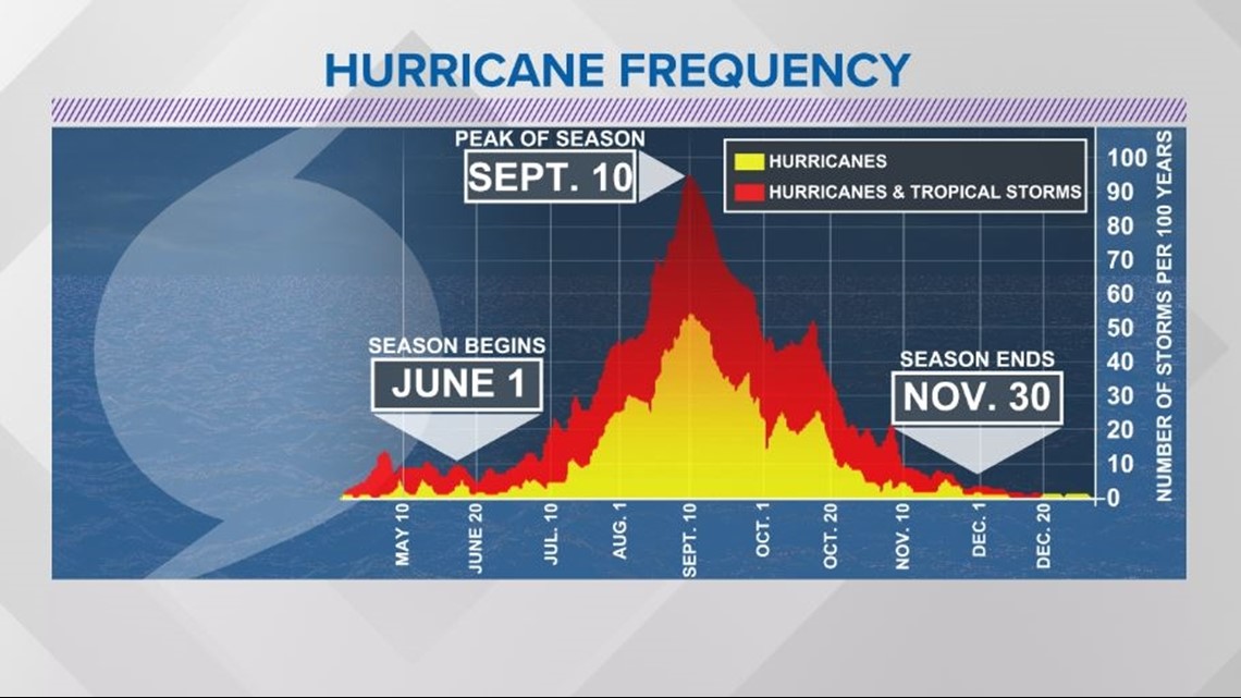
The Atlantic Hurricane Season runs from June 1 to November 30, with the peak of the climatological peak of the season happening on September 10.

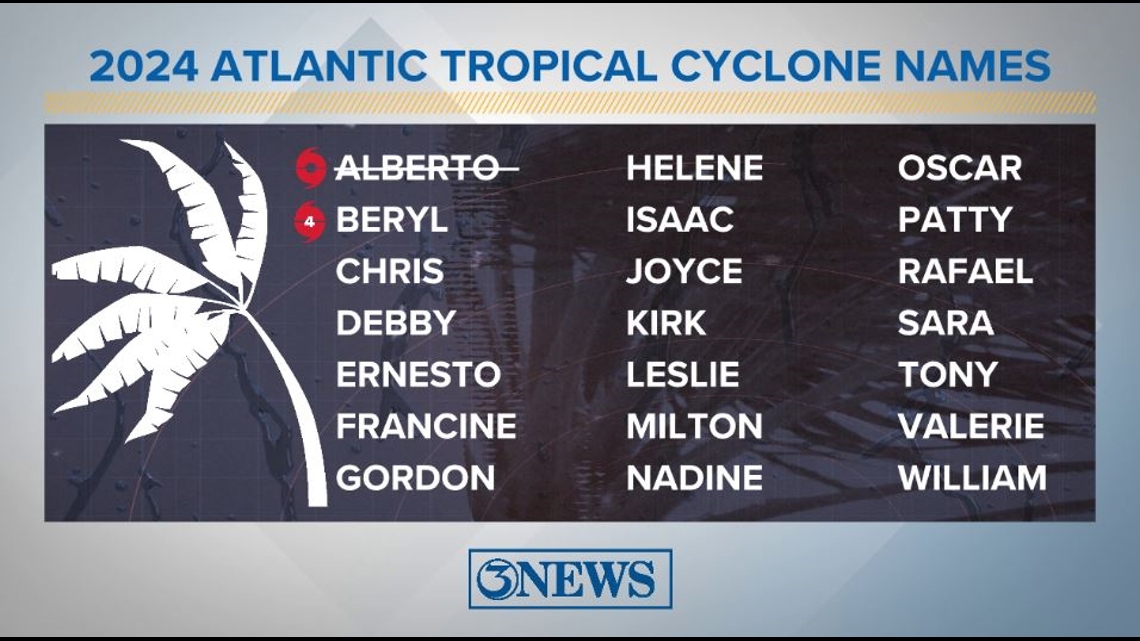
Here are the names for the 2024 Atlantic Hurricane Season. Names are given to tropical cyclones (tropical storms and hurricanes).

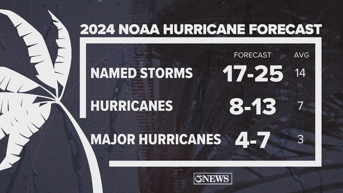
On May 23, NOAA released their forecast for the 2024 Atlantic Hurricane Season. They're predicting an above-average year, with 17-25 named storms. This is the highest pre-season forecast they've ever issued.
The high number of storms forecast is due to near-record sea surface temperatures and the return of La Nina, both of which favor tropical cyclone development. We talk more about those in our Hurricane Special, which you can watch here!

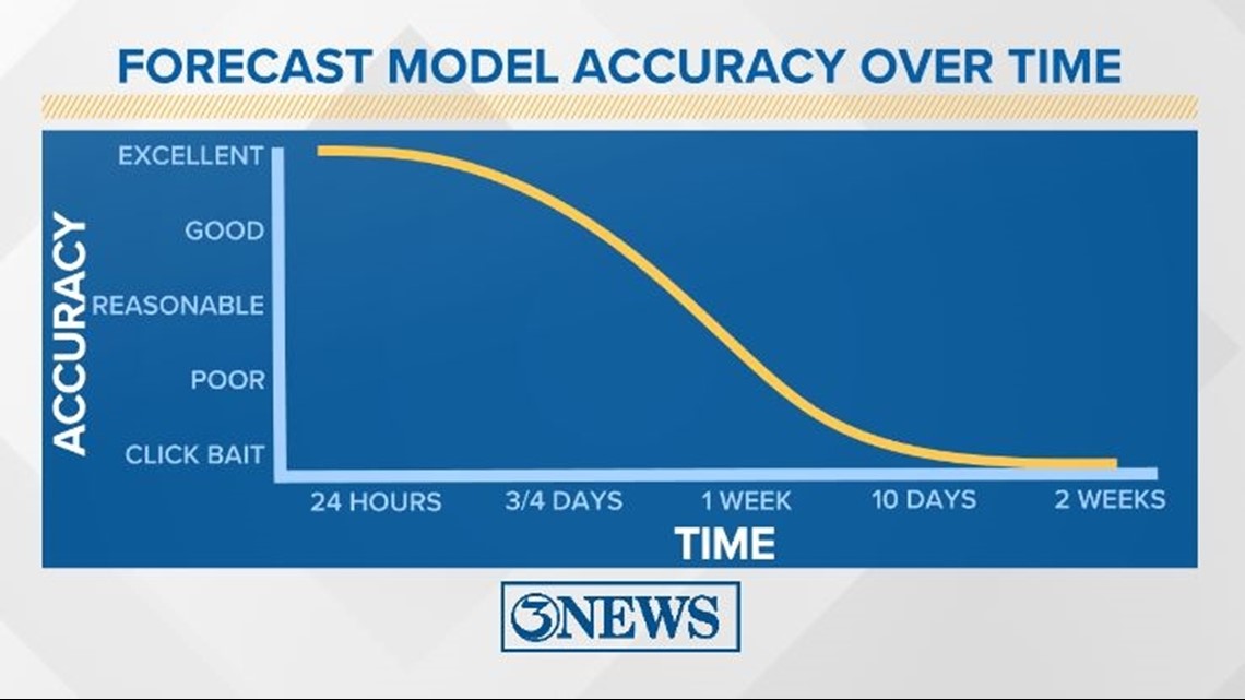
Remember to not "anchor" to the first forecast you see - forecasts change. Also, rely on a credible source for your tropical information and forecasts.