
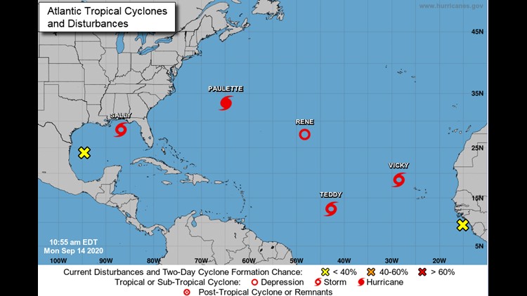
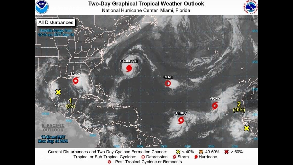
SAN ANGELO, Texas — September is statistically known as the "peak" of hurricane season in the Atlantic basin, and this year it is living up to its name. There are currently seven areas to watch in the Atlantic, including Tropical Storm Vicky who formed at 10 a.m. Monday.

It is the 20th-named storm this season in the Atlantic. Only one storm name remains, Wilfred. After Wilfred, the National Hurricane Center (NHC) will begin to use the Greek alphabet when naming tropical systems. This has only been done once before, in the historic 2005 Hurricane season when Alpha, Beta, Gamma, Delta, Epsilon and Zeta were used.
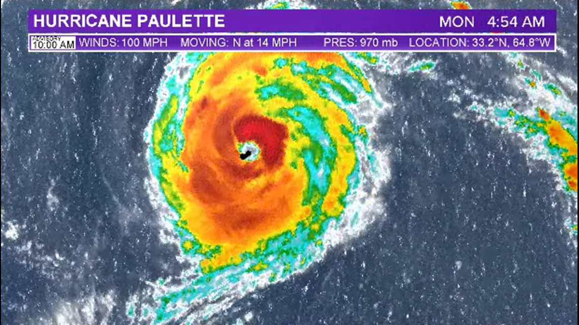
Two of the current seven active systems threaten land, as of Monday. As of 10 a.m., Hurricane Paulette is a 100 mph category 2 hurricane. It made landfall over the small island nation of Bermuda overnight.

Tropical Storm Sally continues to strengthen in the northern Gulf of Mexico as it pushes to the west-northwest. As of the 10 a.m. advisory, sustained winds were 65 mph.

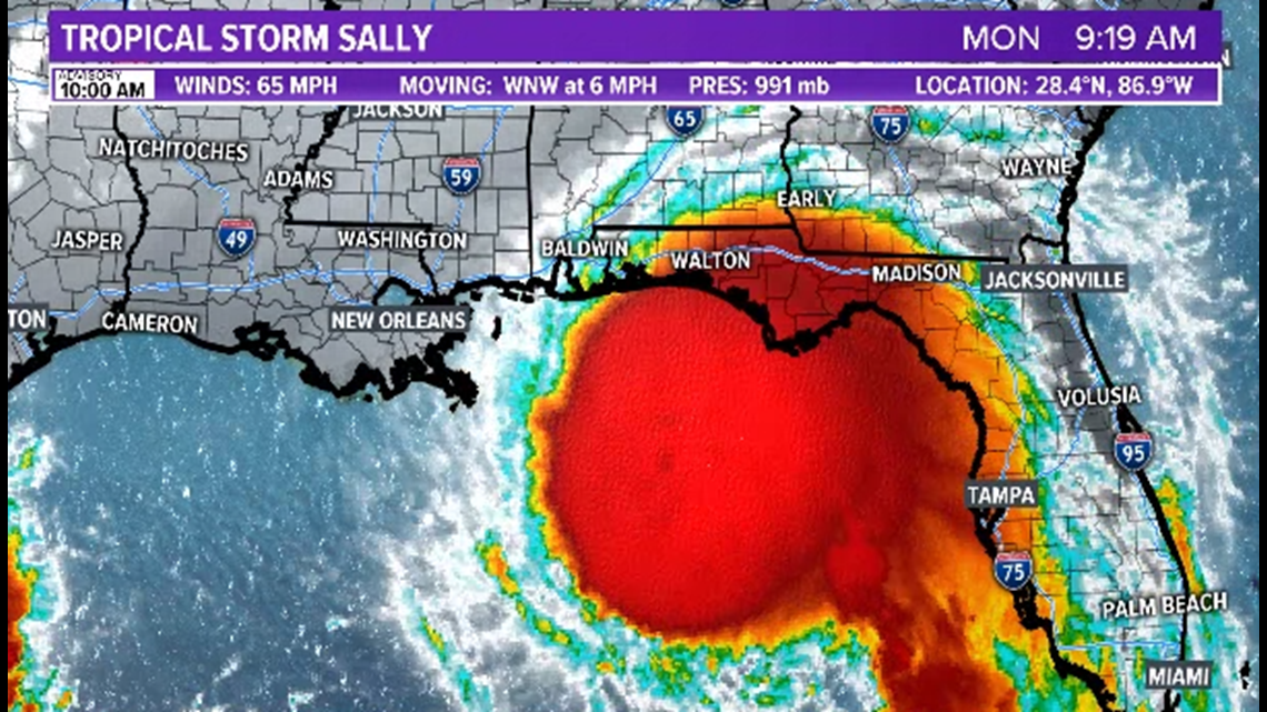
The environment Sally will move over is very favorable for development as additional strengthening is expected. Water temperatures hover in the 80s with very little shear to disrupt the storm. Sally is expected to become a category 1 hurricane Monday afternoon as it nears the Gulf Coast.
As it does so, the storm is expected to slow down even further than its already slow 6 mph speed. It will sit just offshore southeast Louisiana, southern Mississippi and southern Alabama for about 24 straight hours through Tuesday evening.

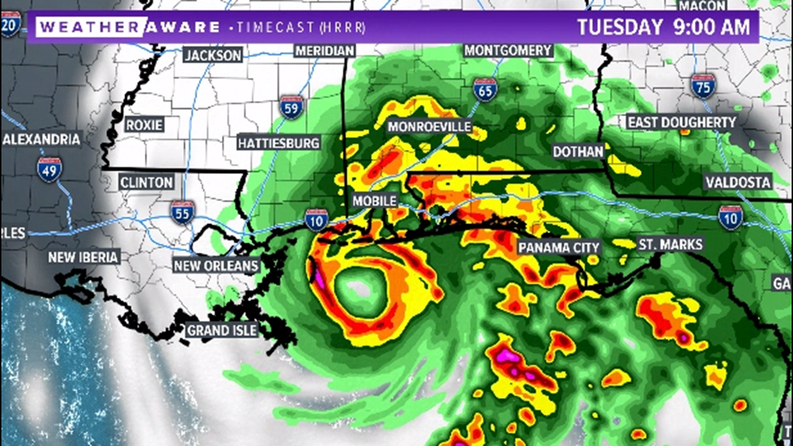
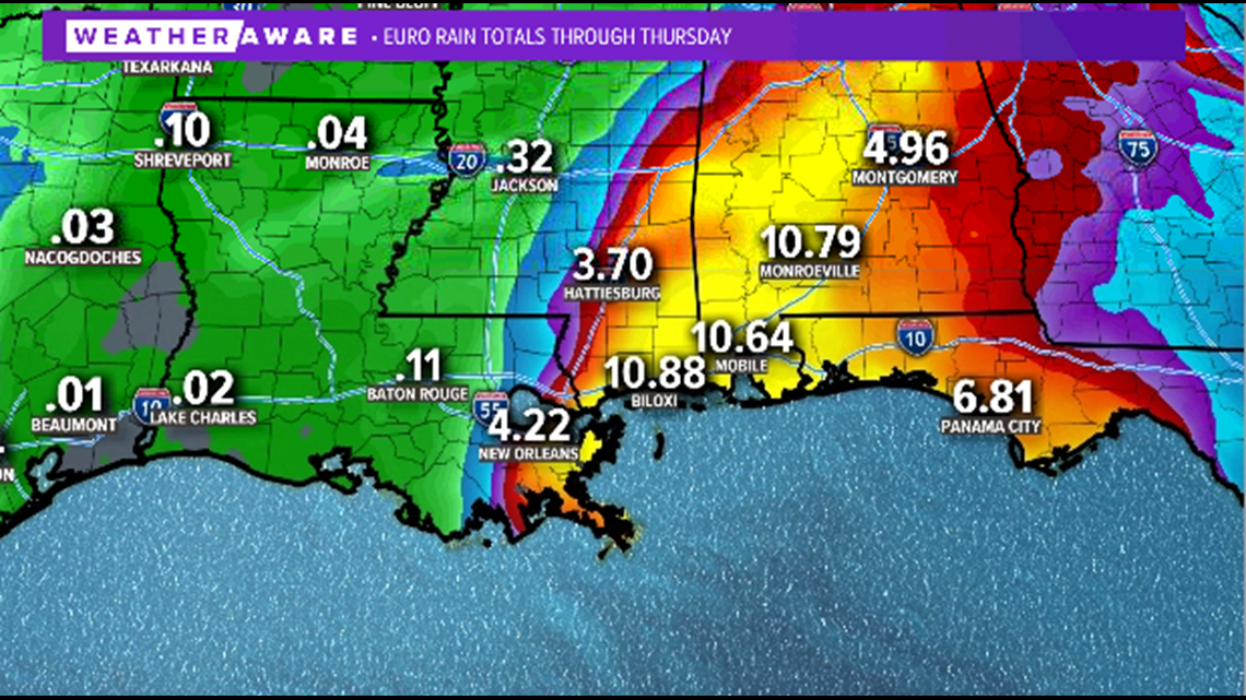
Because of its slow speed, rainfall will be the biggest threat from this system. More than 10 inches of rainfall is likely in southern Mississippi, southern Alabama and the Florida panhandle. Isolated locations may see upwards of 20 inches of rain, leading to immense flooding.

Storm surge will also be a concern from southeast Louisiana to the Florida panhandle.
Stay with FOX West Texas for the latest information.