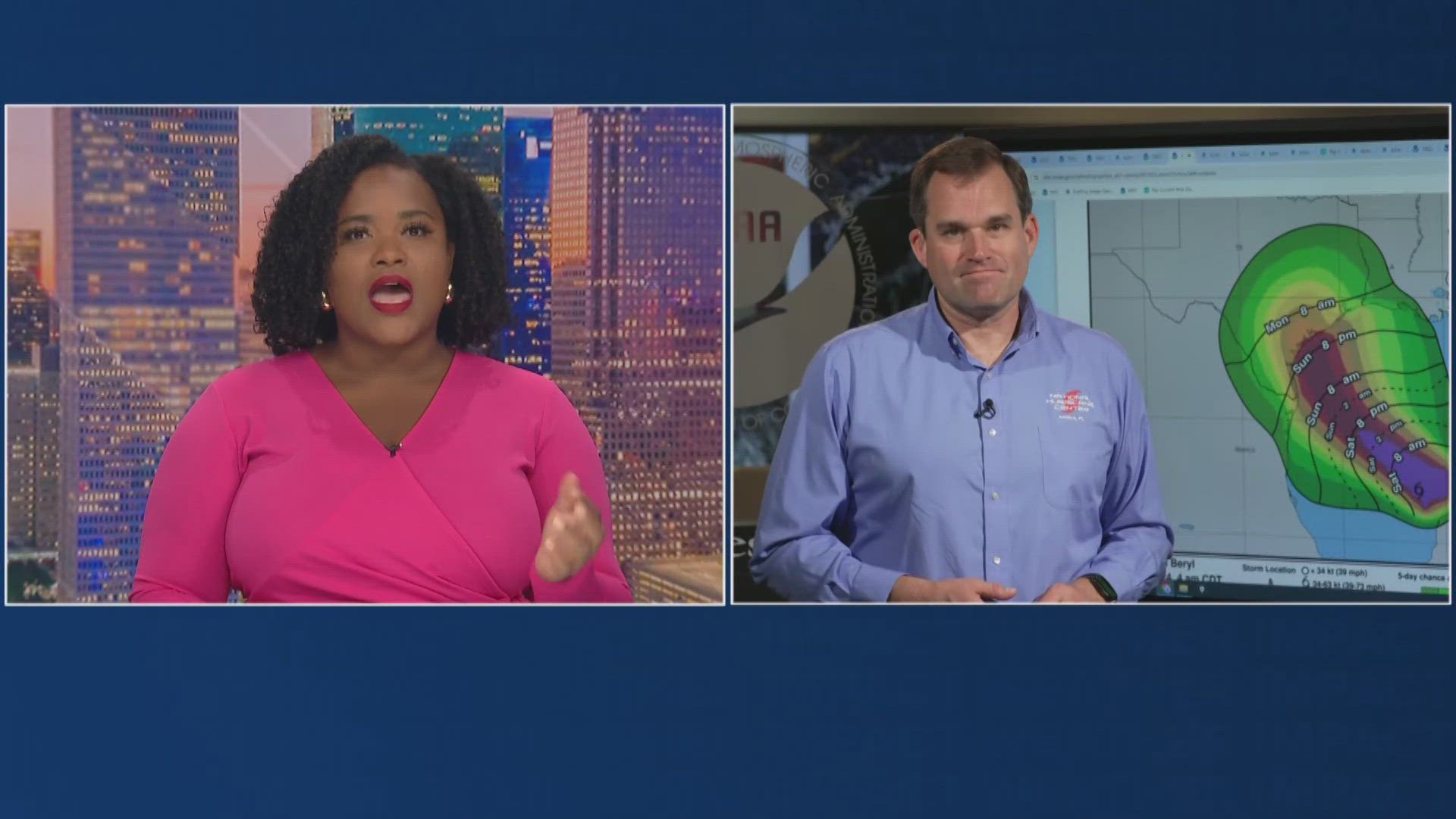
HOUSTON — With Beryl moving closer to the Texas coastline, we know you have questions. On Saturday morning, we talked to Dr. Michael Brennan, director of the National Hurricane Center, about what we can expect in the Houston area from Beryl and the timing.
Saturday morning, Beryl was a tropical storm that was expected to intensify back into a hurricane as it continues to move over Gulf waters. Brennan talked about the track and the challenges this storm posed.
“With a track sort of parallel to the coast, it doesn't take a huge shift away to say the right of our track to have landfall much farther up the Texas coast or to the left of the track, to have it come in farther south, so that's why we've issued such a big hurricane watch that goes all the way from the mouth of the Rio Grande all the way up to San Luis Pass. And with that storm surge watch for the potential of that life-threatening surge inundation, all the way up to High Island.”
Brennan said Saturday is really your day to prepare.
“Conditions are going to deteriorate during the day tomorrow and especially tomorrow night into Monday,” said Brenna.
As far as the timing, he said tropical storm force winds will reach portions of the Texas coast Sunday evening, so you have Saturday and most of the day Sunday to prepare.
And as for conditions further inland, Dr. Brennan said expect wind and a lot of rain.
“We're only expecting very slow intensification through the day today (Saturday) and even into overnight tonight and early Sunday morning and then expecting more quick intensification as Beryl approaches the Texas coast, basically starting during the day Sunday and continuing up through landfall, so we are expecting Beryl to intensify and regain hurricane intensity. After that time, it's going to move quickly inland. I do want to touch quickly on the rainfall threat. We are looking at the potential for 5 to 10 inches of rain, widespread totals with isolated amounts as high as 15 inches along the Texas Gulf Coast and inland over East Texas beginning Sunday and continuing into the middle of next week. So a potentially multi-day heavy rainfall event with the potential for pretty some pretty significant flash flooding in areas.”

