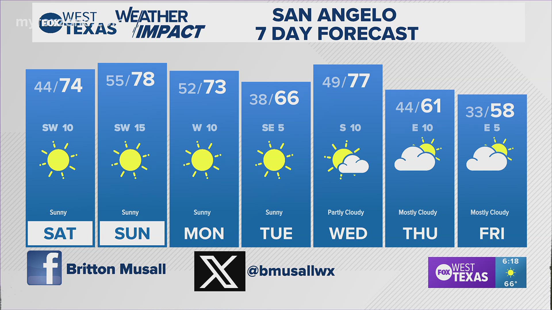
SAN ANGELO, Texas — Monday afternoon featured a massive temperature variant across West Texas. Afternoon highs climbed into the upper 70s to lower 80s throughout much of the Concho Valley, while Big Country temperatures remained in the 40s and 50s. This is all because of a cold front that stalled across the region and became a stationary front.
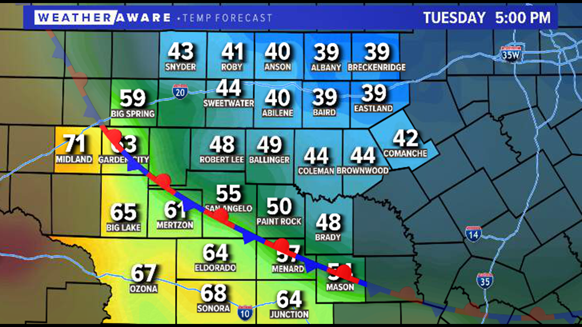
This stationary front will continue to sit across West Texas Tuesday and Wednesday which will create a large temperature variant throughout the area. Temperatures Tuesday will stay well below-average in our northeastern communities while our southwestern communities will once again climb above average.
5 p.m. Tuesday projected temperatures:

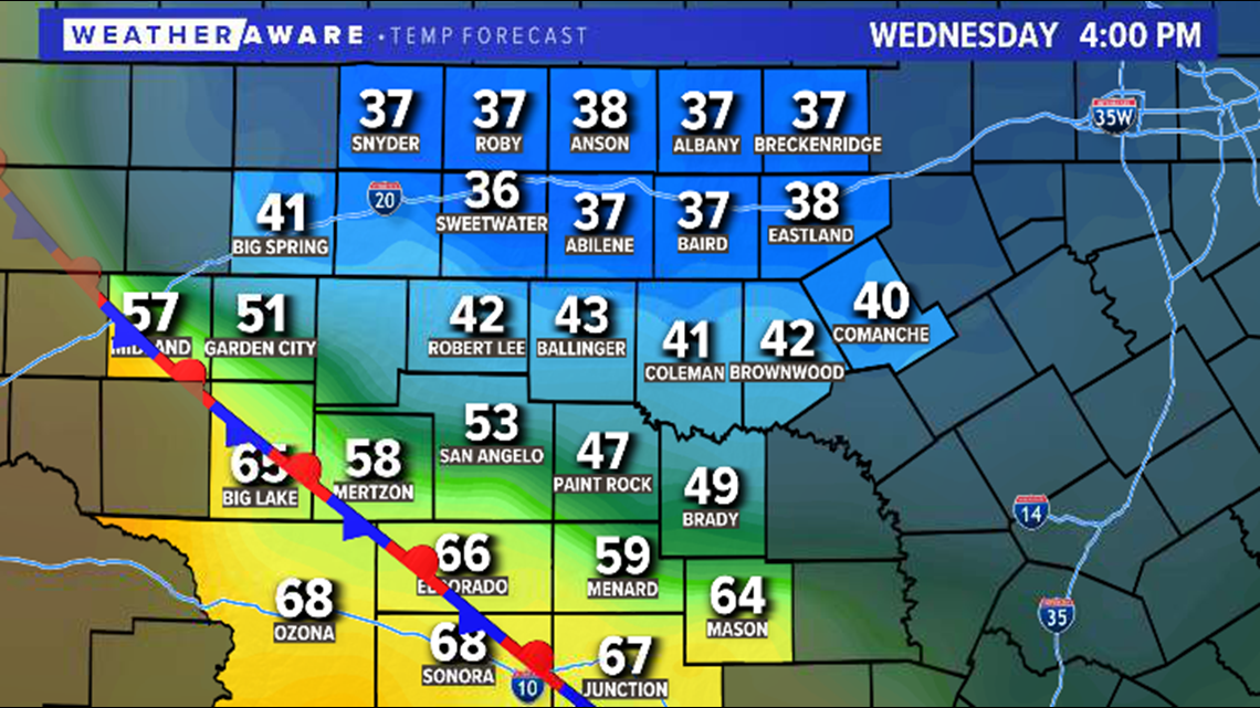
This will continue to be the case Wednesday when another large temperature variant is expected across the area because of the stalled front.
4 p.m. Wednesday projected temperatures:

Thursday, a stronger shot of cold air will push in from the north. This will cause temperatures to plummet throughout the area as an arctic air mass settles into the region.
5 p.m. Thursday projected temperatures:

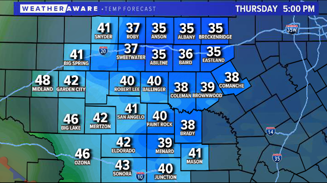
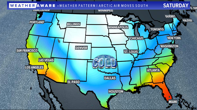
This frigid air mass will continue to push south throughout the upcoming weekend and settle across the Lone Star State.


A few models bring brutally cold temperatures into the region this weekend. Wind chill values may drop to near zero degrees by early Valentine's Day morning.
Projected feels-like temperatures early Sunday:

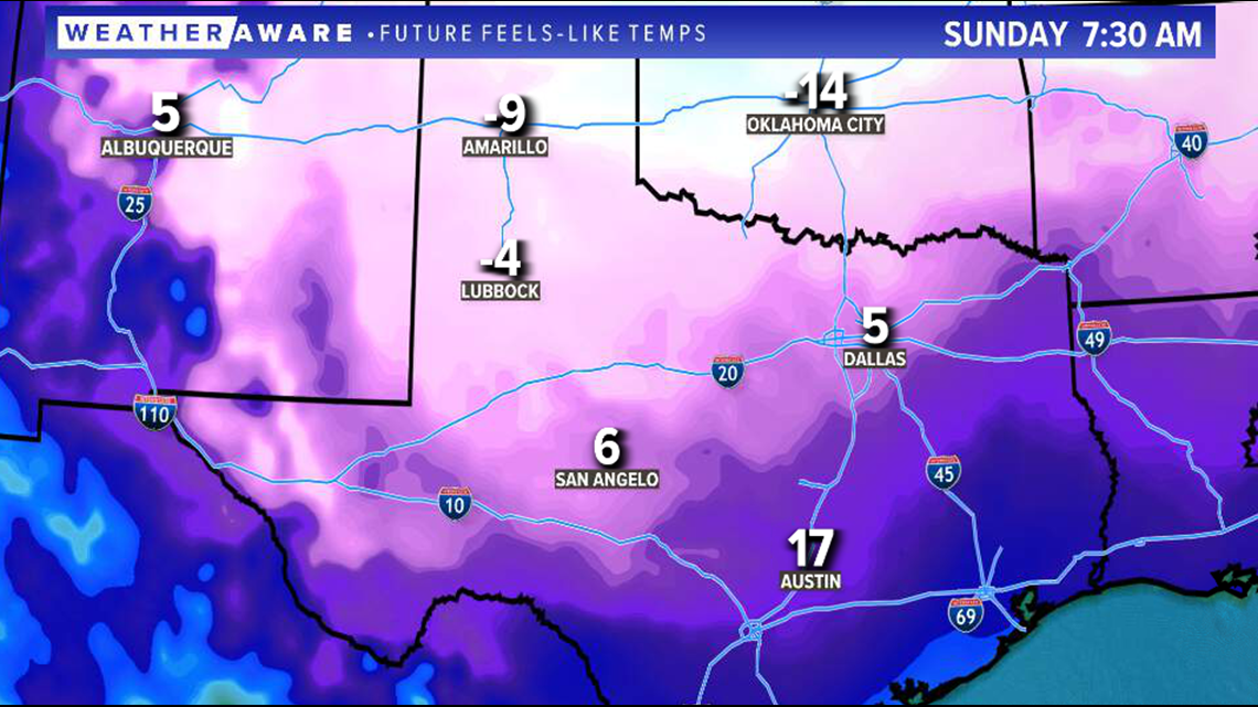
Prepare for dangerously cold temperatures this upcoming weekend and stay with FOX West Texas for the latest information.

