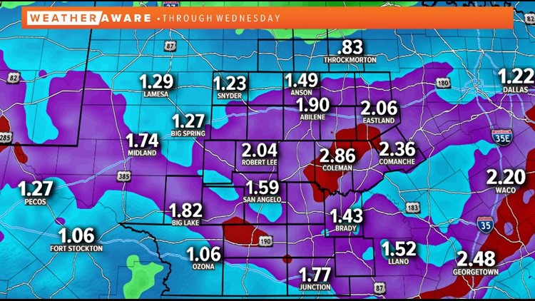
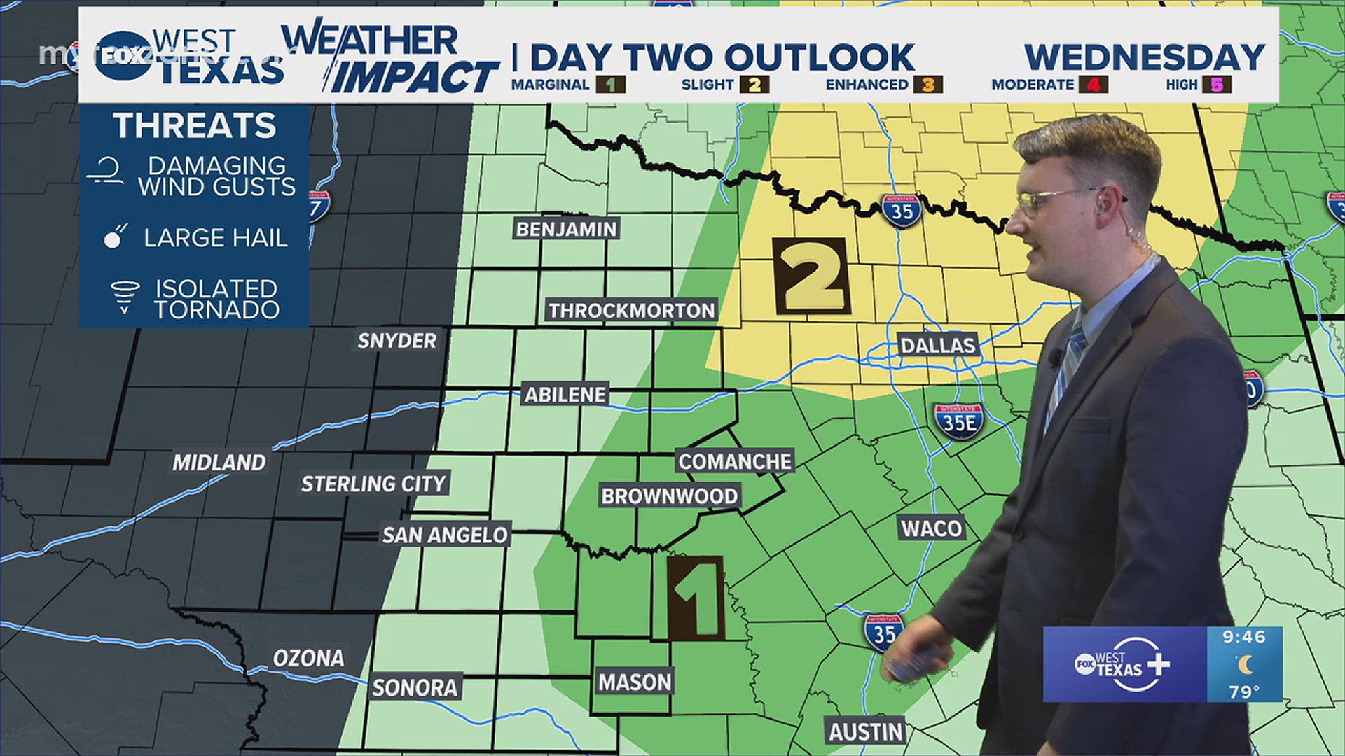
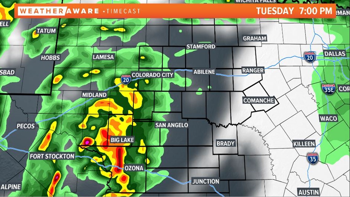
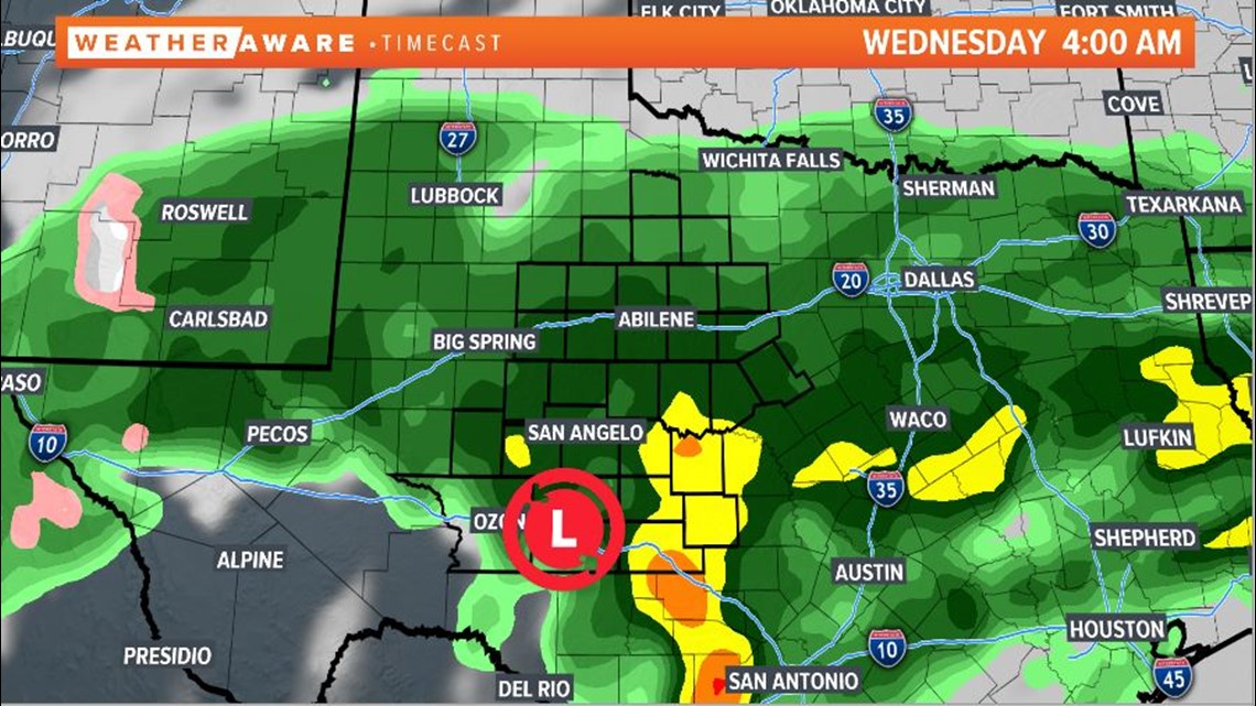
A storm system moving into West Texas over the next two days will bring heavy rainfall to the area. Isolated showers are possible overnight Monday into Tuesday. However, the majority of the activity will hold off until late Tuesday into Wednesday. Rain is likely to begin Tuesday evening to the west and move eastward through the night. A few storms are likely to be strong to potentially severe, with damaging winds and hail being the main threat.

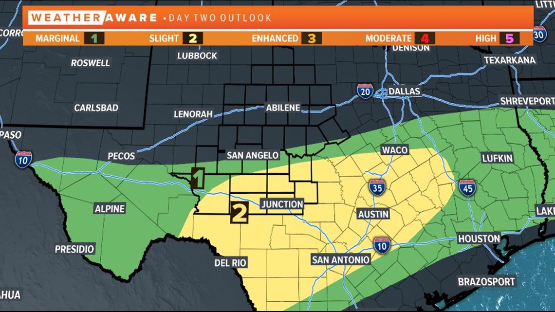
The Storm Prediction Center (SPC) has placed our southern counties under a slight risk of severe thunderstorms. This is a level two of five.

The main threat from this system, however, will be the heavy rainfall that is likely throughout the area. Moderate to heavy rainfall will be likely from late Tuesday evening through mid-day Wednesday. Temperatures will also be much cooler Wednesday with highs only reaching the middle 50s.

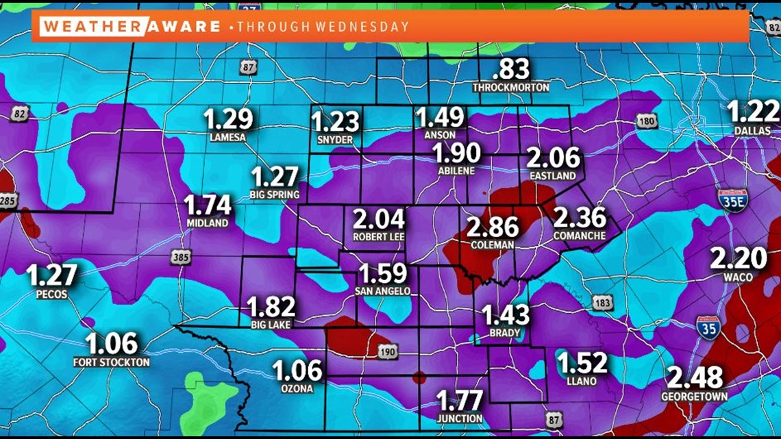
Rainfall totals throughout the area for this event will be in excess of an inch, with localized areas picking up on two to three inches of rain.

We dry out on Thursday with lots of sunshine and temperatures back near 70 degrees.
Stay with FOX West Texas for the latest information.


